• An Giang
  • Binh Duong
  • Binh Phuoc
  • Binh Thuan
  • Binh Dinh
  • Bac Lieu
  • Bac Giang
  • Bac Kan
  • Bac Ninh
  • Ben Tre
  • Cao Bang
  • Ca Mau
  • Can Tho
  • Dien Bien
  • Da Nang
  • Da Lat
  • Dak Lak
  • Dak Nong
  • Dong Nai
  • Dong Thap
  • Gia Lai
  • Ha Noi
  • Ho Chi Minh
  • Ha Giang
  • Ha Nam
  • Ha Tinh
  • Hoa Binh
  • Hung Yen
  • Hai Duong
  • Hai Phong
  • Hau Giang
  • Khanh Hoa
  • Kien Giang
  • Kon Tum
  • Lai Chau
  • Long An
  • Lao Cai
  • Lam Dong
  • Lang Son
  • Nam Dinh
  • Nghe An
  • Ninh Binh
  • Ninh Thuan
  • Phu Tho
  • Phu Yen
  • Quang Binh
  • Quang Nam
  • Quang Ngai
  • Quang Ninh
  • Quang Tri
  • Soc Trang
  • Son La
  • Thanh Hoa
  • Thai Binh
  • Thai Nguyen
  • Thua Thien Hue
  • Tien Giang
  • Tra Vinh
  • Tuyen Quang
  • Tay Ninh
  • Vinh Long
  • Vinh Phuc
  • Vung Tau
  • Yen Bai

Exhibition on Hoang Sa & Truong Sa archipelagos opens

VGP - Nearly 150 maps, publications, and artifacts are on display in Da Nang city at an exhibition titled “Hoang Sa, Truong Sa archipelagos are of Viet Nam’s sovereignty – historical evidence”.

January 19, 2014 3:52 PM GMT+7
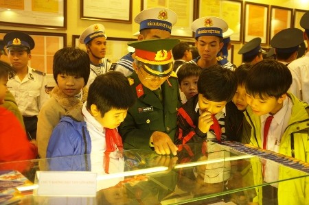
Illustration photo

The most notable are four atlas published by the Chinese Qing dynasty and the Chinese government. They show that China’s southernmost part is in Hainan island. Hoang Sa and Truong Sa archipelagos are not included.

The exhibition showcases historical evidence or objective factors of the past that we have collected, said Duong Trung Quoc, Vice President and Secretary General of the Viet Nam Association of History.

"They are legal and historical foundation to prove Viet Nam's sovereignty over sea and islands, including Hoang Sa and Truong Sa archipelagos", said Mr. Duong Trung Quoc.   

The exhibition will last on January 25./.

By Khanh Phuong