Maps show VN's sovereignty over Hoang Sa, Truong Sa
VGP - The following maps, published by China, Viet Nam and foreign countries, all show that the southernmost part of China is Hainan island.
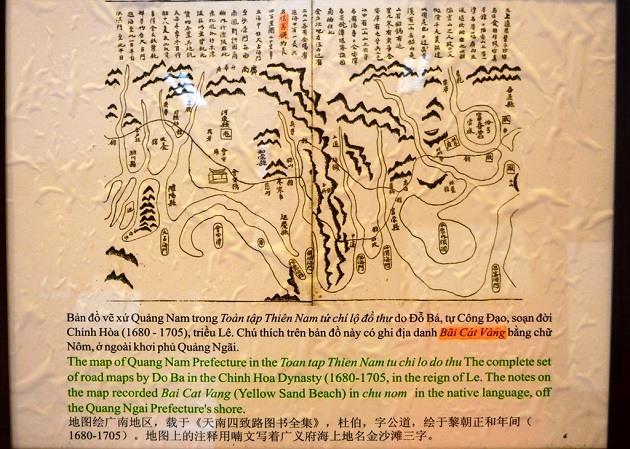 |
| The map of Quang Nam Prefecture in the Toan tap Thien Nam tu chi lo do thu. The complete set of road maps by Do Ba in the Chinh Hoa Dynasty (1680-1705), in the reign of Le. The notes on the map recorded Bai Cat Vang (Yellow Sand Beach) in Chu Nom in the native language, off the Quang Ngai Prefecture's shore |
 |
|
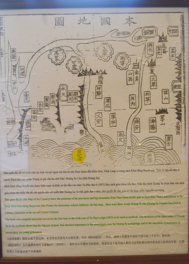
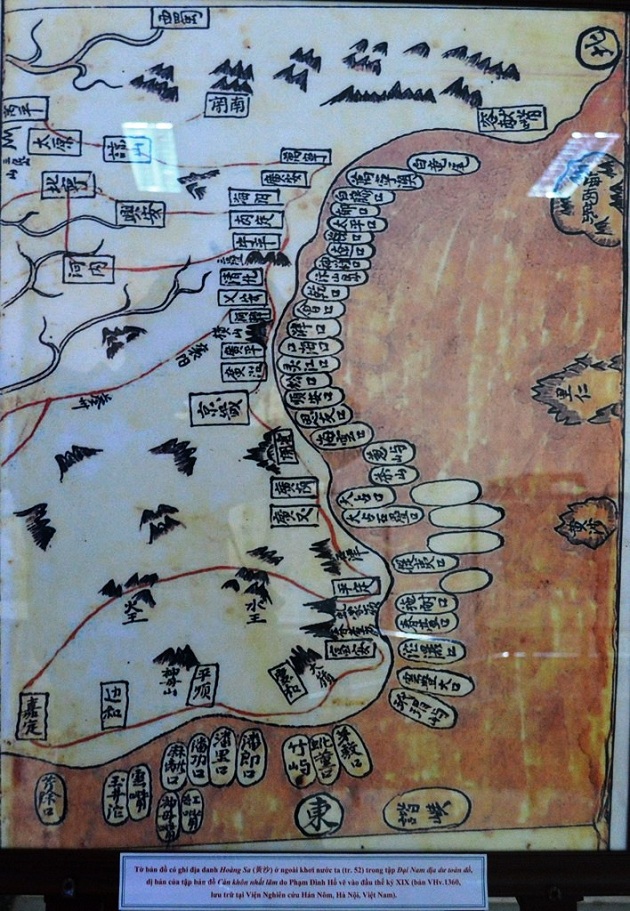
The Ban Quoc Dia Do (The Map of the Country) drew the position of the provinces and big mountains from Nam Quan border gate to Bien Hoa, Vinh Long printed in the book titled Khai dong thuyet uoc (The primer for elementary school children). On this map, there were three words Hoang Sa chu (Hoang Sa islands) inscribed in Chinese characters at the sea off Central Viet Nam The book was compiled and print-carved for the first time in the sixth year of Tu Duc's reign (1853) to be used as text book. The inclusion of the place name of Hoang Sa in the textbook show that the Nguyen dynasty had attached importance to the sovereignty over Hoang Sa archipelago and to the education of awareness of sovereignty for young generations |
 |
 |
 |
 |
 |
 |
 |
 |
 |
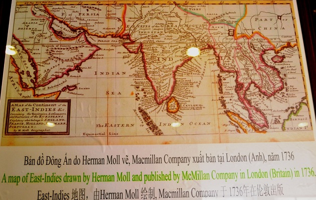 |
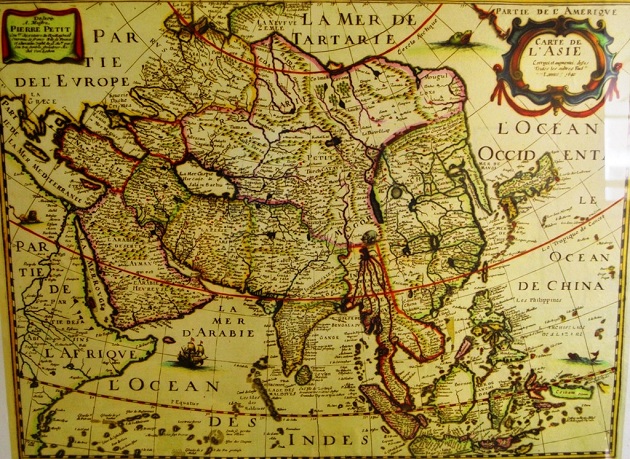
| A map of East-Indies drawn by Herman Moll and published by McMilan Company in London (Britain) in 1736 |
 |
 |
 |
 |
 |
 |
 |
|
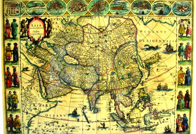
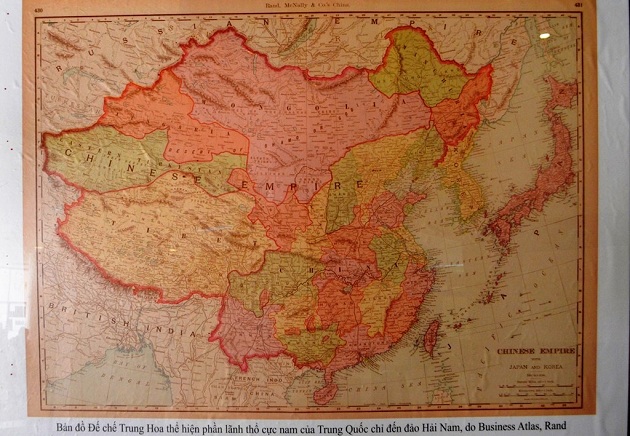
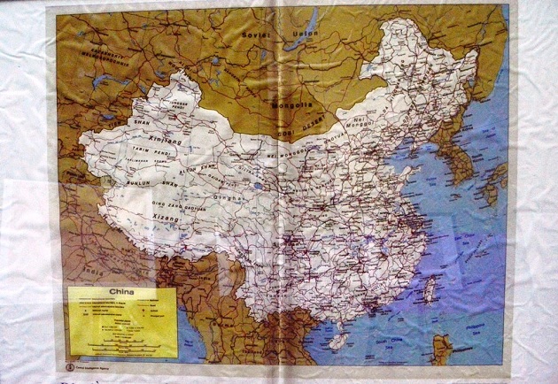
Asian map shows the southernmost part of China only to Hainan province |
 |
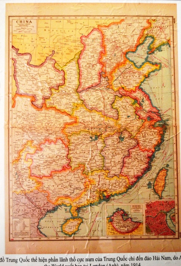 |
| A map published in 1914 in the UK shows the southernmost part of China only to Hainan island |
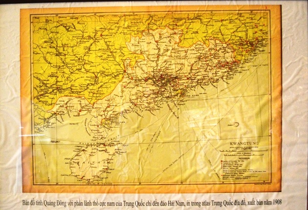 |
| A map of Guangdong province, published in 1908, shows the southernmost part of China only to Hainan island |
 |
|
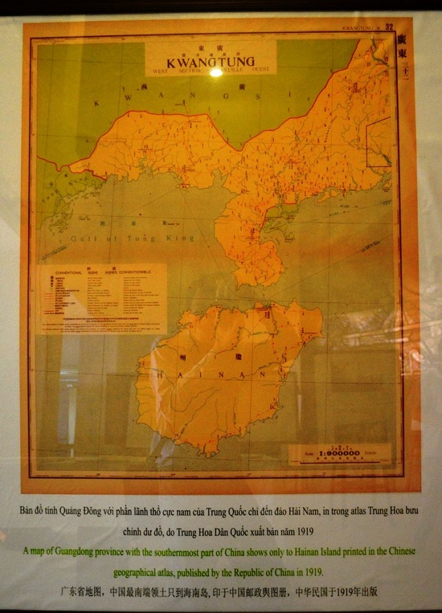
A map of Guangdong province with the southernmost part of China shows only to Hainan Island printed in the Chinese geographical atlas, published by the Republic of China in 1919 |
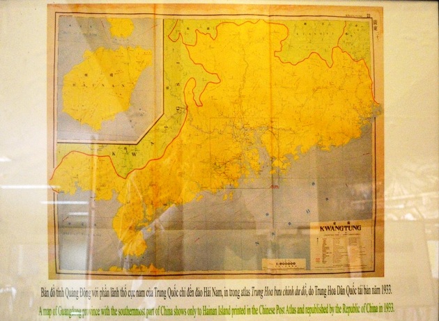 |
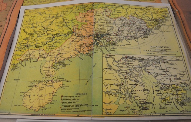
| A ma of Guangdong province with the southernmost part of China show only to Hainan province printed in the Chinese Post Atlas and republished by the Republic of China in 1933 |
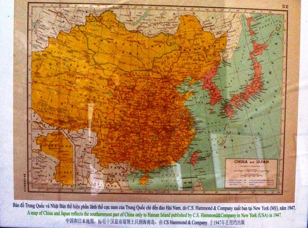 |
| A map of China and Japan reflects the southernmost part of China only to Hainan island published by C.S. Hammoed &Company in New York (USA) in 1947 |
 |
 |
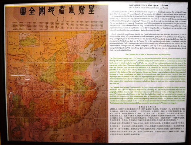 |
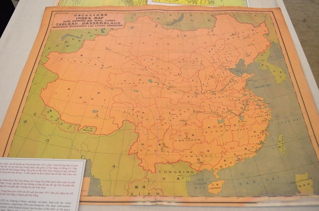
| The complete set of maps of provinces under the Qing dynasty |